PROFESSIONAL TIPS AND TACTICS TO LEVERAGE SYNOPTIC WEATHER
Every sailor, without exception, will experience a shift in the wind’s direction as they sail near or through a Cold Front — the scale of the wind shift can span a thousand miles! Heavy weather frequently blows near a Cold Front but that’s not guaranteed; CF-severity is characterized in three ways: extreme, moderate, or mild.
You can learn to leverage a Cold Front’s weather pattern to help you win a regatta or complete a safe offshore passage — it’s important to understand how Cold Fronts behave as their influence dominates a sailor’s plans for 2-3 consecutive days; and, CFs affect all sailors several times per year.
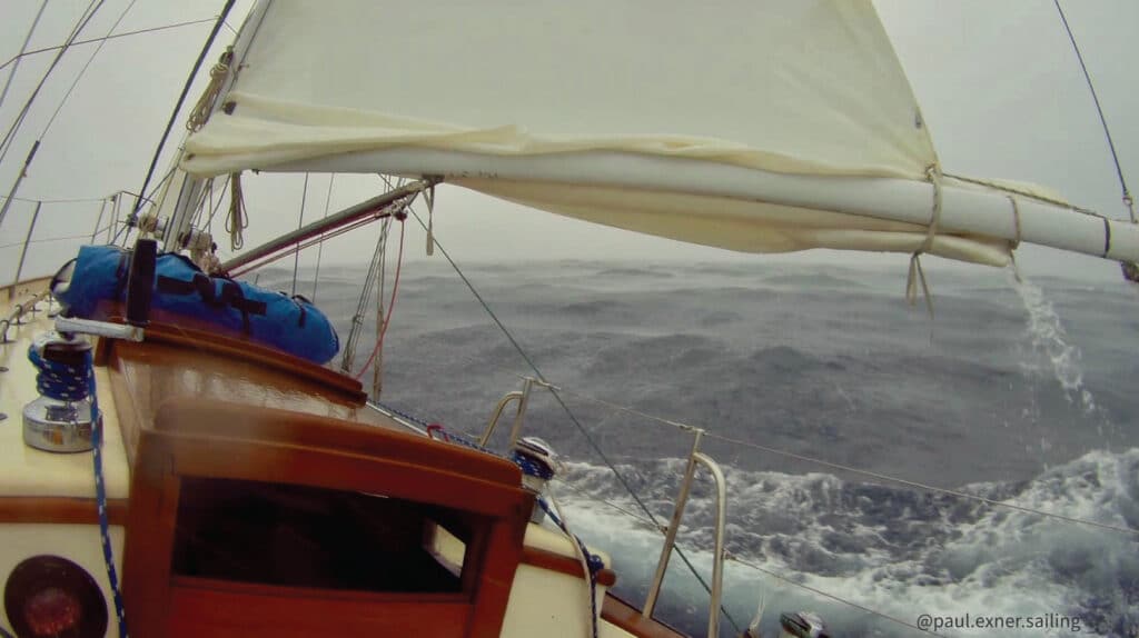
I’ve experienced more Cold Fronts at sea than I should have — the worst I endured was in the middle of the Gulf Stream off Charleston, S.C. in April when a post-frontal Nor’easter hammered us on a passage to Puerto Rico — gale force winds opposed the Stream’s 2.5 knot current and “holes” formed in the sea surface large enough for our boat to fall into — two yachts foundered in the wake of that Cold Front, and a pre-season hurricane unexpectedly spun up on the frontal axis a few hundred miles south of us.
To help you sail in the proximity of Cold Fronts, here are my pro sailing tips and tactics based on the expected atmospheric behavior of this powerful weather phenomenon; I’ve also included some points about what to watch out for.
TIP 1: NUMERICAL WEATHER MODELS STRUGGLE WITH FRONTAL TIMING
Without a doubt, GRIB Files and post-processing apps display weather model output to help sailors gain clear expectations about the sailing conditions they’ll encounter, but Cold Fronts behave elusively and can’t be perfectly modeled. In the natural world CFs accelerate, stall, and morph their boundary in ways “the math” can’t resolve; they also tend to deepen as they move offshore and away from a continent, posing further problems for model convergence in transitory phases. CF behavior simply cannot be modeled with high accuracy down to the hour — often, CF frontal boundaries can be mis-modeled by as much as a day!
Despite modeled inaccuracies with Cold Fronts, their atmospheric mechanics do behave consistently enough for a sailor planning and taking routing actions IF the sailor knows what to look for. Let’s dive more into CF behavior in the TIPS below; but, for now, hear this: the sailor must always analyze their immediate surroundings and make their own judgment about a Cold Front’s timing irrespective of numerical predictions.
TIP 2: WIND-SHEAR AT THE COLD FRONT BOUNDARY
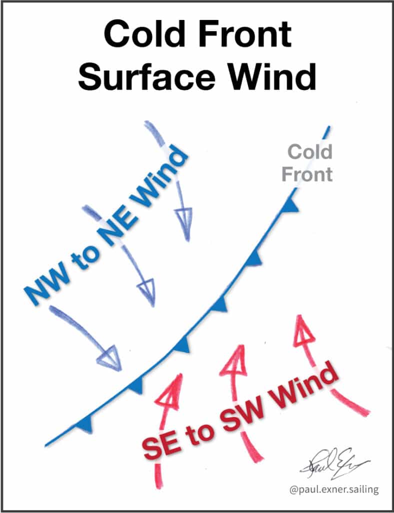
Surface winds converge on a Cold Front’s boundary, creating an opposing wind direction on opposite sides of the front (known as horizontal wind shear); this occurs in relation to how the atmospheric pressure is distributed around the CF and influenced further by the Coriolis Effect.
The Coriolis Effect causes the wind to change its direction by bending its flow rightward in the north hemisphere on a regional scale.
As surface winds are drawn into the Cold Front’s line of low atmospheric pressure, sailors can expect to see a consistent unfolding wind direction pattern as the front passes over them:
- Preceding the Cold Front, a persistent wind shift first materializes from the southeast and clocks to blow from the southwest in close proximity to the frontal boundary. The wind speed likely increases as it clocks.
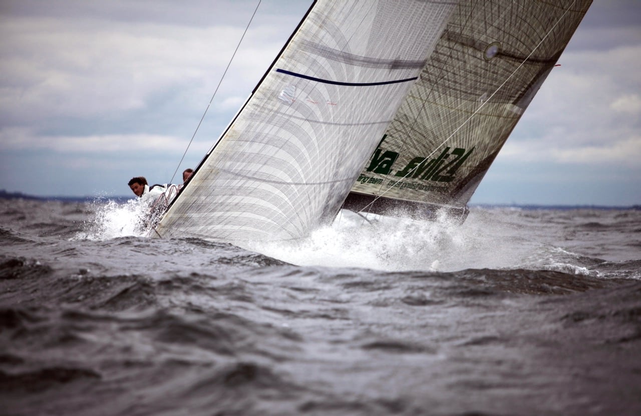
- The frontal boundary of the Cold Front will produce widely varying conditions depending on the storm itself; expect anything from: dead calm, gentle breeze and severe thunderstorms to rain, gale force wind, and completely overcast skies.
- Following the Cold Front, the brunt of the advancing cold air mass typically fills in and blows from the west-northwest; although, the specific westerly component of the wind is totally unique to each individual storm. Then, the wind builds in strength as the regional gradient establishes itself over the next few hours — the wind sometimes dies out if the CF is mild — but, if the CF is characterized as “extreme” the wind will blow HARD for a day or two especially in the ocean if the front leaves the continent and advances seaward. During this final phase of the Cold Front, we’ll see the wind’s direction continue to clock from the west-northwest to the north, and sometimes clocking further to the northeast.
Even though I’ve specified the expectations for a Cold Front passage above, mother nature occurs on a planet rocketing through space — I fully realize my TIPS are considered general info.
Nevertheless, the wind shift pattern I’ve outlined above happens consistently throughout the northern hemisphere — if you truly “own” these concepts, you can detect the nuanced weather for each Cold Front, leveraging your sailing routes to the Moon and back!
TIP 3: DEVELOP CRYSTAL BALL AWARENESS
When a sailor can intellectually interpret a WX forecast and naturally sense how the sailing conditions will unfold in the vicinity of a Cold Front, and then make routing decisions that leverage their plan as if they saw everything clearly in a crystal ball — wow — they’re living a guru reality.
ANY sailor can develop this level of awareness: racers, day sailors, and voyagers. By practicing the art of sailing at this level you’ll experience one of the greatest enjoyments a sailor can know.
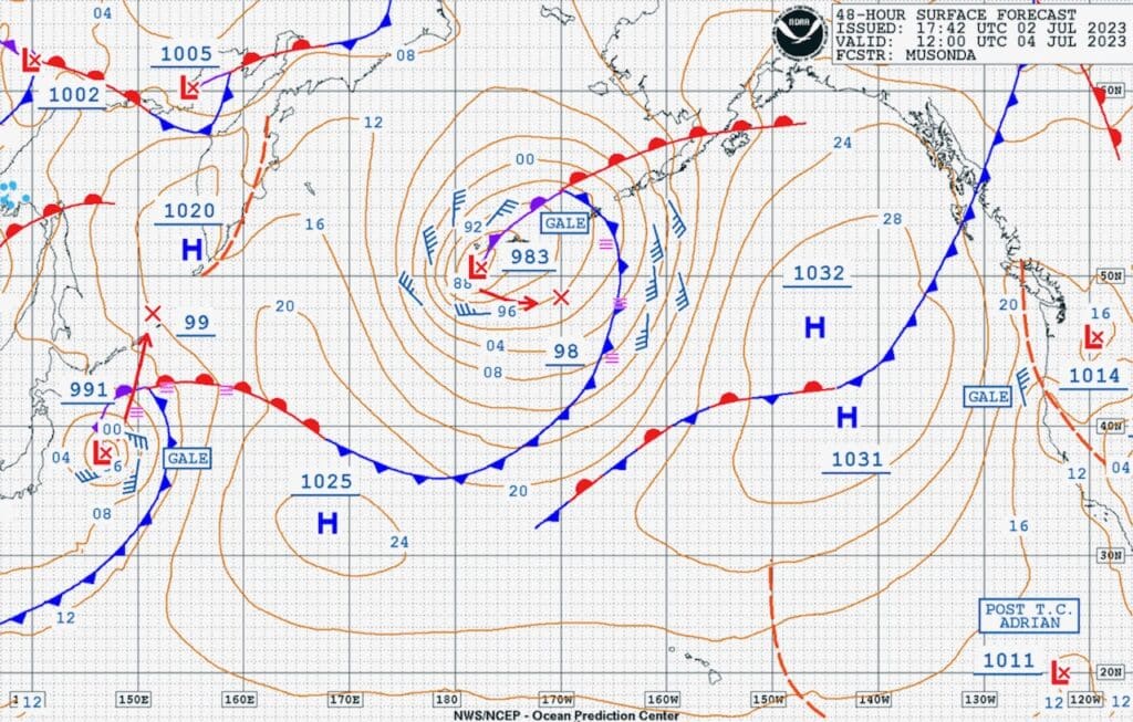
To develop this awareness for yourself, study the step-by-step account of a Cold Front I outlined in TIP 2 and compare the info to your firsthand observations of your immediate weather. Ask yourself: what’s the wind direction and speed? Could a CF be near or within several hundred miles of you? Consider the atmospheric mechanics presented in TIP 2 in relation to the nomenclature depicted on the Surface Analysis Reports published by your national meteorological office; try to relate your immediate wind direction and speed to any nearby Cold Front depicted on the Surface Analysis Report. How will the forecasted CF move in the next 24 – 48 hours relative to your position? Make your own weather prediction and monitor the wind over the next two days. Compare your own forecast to what you observe locally.
I’ve practiced this same self-coaching method myself over the past twenty years — it has undoubtedly helped me grow my awareness of synoptic weather, and I’ve successfully sailed many highly leveraged routes near Cold Fronts. I encourage you to do this work for yourself; when you do, you will greatly advance your ability to interpret the unfolding weather as if you had a crystal ball.
The on-the-water benefits received by efficiently leveraging the mechanics of a Cold Front help us create a multi-day sailing strategy. Remember: we’re influenced by Cold Fronts hundreds of miles away from us as they steadily morph and unfold day-after-day.
TIP 4: LEVERAGED SAILING STRATEGY FOR PERSISTENT WIND SHIFTS
There’s SO much to say about leveraged sailing and persistent wind shifts — an entire book could be written, mostly because our actions depend on numerous boat-specific performance factors and every routing situation is different, but I’m compelled to include a few points to get you thinking and consider a few out-of-the-box options.
Let’s look at two separate sailing cases for persistent wind shifts: 1) You’re sailing a regatta with multiple races in the same day, 2) You’re sailing a lengthy offshore leg greater than 24 hours.
First, you absolutely must understand the atmospheric mechanics driving the wind coming from the Cold Front on the day, and believe with conviction that you can accurately predict which way the wind will shift throughout that day. Refer to TIP 2 to review these mechanics.
Force yourself to make a prediction with conviction — the only way to advance knowledge is to make an educated guess, leverage our decisions regarding the guess, and take note of how our decisive actions play out.
TIP 4.1 — Sailing several races on the same day as the wind shifts persistently: To perform well in this environment, sailing angle data must be collected to identify the “fast lane” headings coming off the starting line on both port and starboard tack. You must begin collecting data as soon as you hit the water, and continually collect new data so your immediate sailing angle can be compared to what you previously collected. Often, wind oscillates as it persistently shifts, so you must filter out aberrations to determine the persistent trend.
You’ll likely notice that wind fills sometimes in spurts from the side of the racecourse where the persistent shift will eventually come from. The leveraging strategy is to simply favor sailing in locations on the race course where the new wind is filling in; then, sail toward the persistently shifting wind, and change tacks before you’ve over-leveraged yourself, keeping in mind that sailing the lesser of two tacking angles to the mark is preferable.
As multiple races unfold throughout the day of racing, there will be several starts and specific legs where the wind will shift more advantageously than others. Identifying and capitalizing on advantageous events is obviously important, but requires you to focus your awareness on the trends. By constantly keeping track of your efficient sailing angles you’ll be more likely to identify the significant events to leverage against. While sailing fast, keep your head out of the boat and correlate the shifting wind to signs of wind pressure on the water.
TIP 4.2 — Encountering a persistent shift on a lengthy offshore leg. NOTE: the most common point-of-sail on offshore legs is reaching, so I’ll focus on strategies that apply to persistent-shifts while reaching (SEE 4.1 for upwind strategy).
Since the evolution of a Cold Front unfolds over several days, my approach to leverage the persistent shift from a CF is to evaluate the wind’s change of direction in terms of 3-6-hour increments (sometimes shorter). If the boat sails 150-200+ miles/day on a reach, and you’re sailing toward a Cold Front, wind changes occur faster than expected.
There are two general approaches to sailing reaching legs: 1) To a compass course aimed at a waypoint; and 2) Helming a desirably fast wind angle where compass heading is less important; this is sometimes called: Fast VMG Sailing.
TIP 4.2.1 — If you’re sailing to one compass number as the wind shifts persistently, the sail trimmer will slowly adjust the sails to the wind’s change over a lengthy period of time simply because the helmsperson is sailing one consistent heading. The sail trim adjustment may be SO subtle you’ll probably not realize there’s a persistent shift causing this — but — you absolutely must notice this persistent change because the boat’s performance suffers when the optimal apparent wind angle for the boat is forgotten in favor of sailing to a compass course. Worse, you probably will NOT notice the persistent shift either — or — you’ll completely miss the full potential to leverage the wind shift!
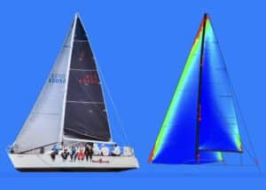
TIP 4.2.2 —To really sail a boat well on a reach and leverage ourselves in accordance with a persistent shift, we must select the optimal reaching sails for the reaching angle that gives the best Velocity Made Good for the waypoint we’re sailing to; having a full inventory of reaching sails to choose from obviously offers us more options. If we’re tight reaching we’ll use a Code Zero. For broad reaching or sailing deeper angles we’ll use an A2 spinnaker. The A3 spinnaker gives us flexibility in the mid-range reaching angles. Talk with your sailmaker about specific reaching sails you might need.
Once we’ve established the optimal sail configuration for the sailing angle that gives us the best VMG, the recommended sailing style is to maximize the groove to sail efficiently fast, irrespective of the bearing to our next waypoint — changing tacks when the most leverage occurs. Accomplishing this automatically puts the boat on an average compass heading as a result of sailing efficiently fast — this is the heading we pay attention to and keep track of over time.
As the persistent wind fills-in and shifts, the first thing we’ll notice is how the boat engages differently in the established wave direction since the wind will shift more quickly than wave direction because water waves propagate in the same direction for days sometimes. Handling the new wave angle as we sail the newly shifted wind requires a new groove through the waves. Pay close attention to your new average compass course and how the value may change over time — put a timer on the evolution of this wind shift and log it! This level of monitoring should be compared to your expectations for how fast the shift will occur, and compare it to the full extent you believe the shift will happen that day. This absolutely helps you leverage the persistent wind shift at the right time.
Ultimately, a leveraged sailing strategy for persistent wind shifts begins by understanding the Cold Front weather mechanics well enough to hedge our bets as to how the wind and weather will change over a few day period, and infer the general timing for each event in the phenomenon. We absolutely must plan how we will sail through a changing wind field that shifts and changes in strength because the ramifications of not doing so affects us on the scale of days. We can infer what sailing angles we’ll sail and we’ll select the most efficient sail configuration. The final actions we take are those that allow us to sail an optimized groove that hedges us toward our waypoint with consideration for which leveraged sailing strategy is best.
Paul Exner Pro-Sailing Tips are written exclusively for UK Sailmakers sailors.
I coach sailors to handle extreme conditions on the water that requires in depth virtual training before we embark — you should check out my 9-week virtual mastermind and Alenuihaha Channel Expedition; it’s the best heavy weather sail training and sailboat prep guidance for sailors seeking confidence in extreme offshore weather.
Email me your questions at: paul@moderngeographic.com and click here for more information on upcoming expeditions.
Here’s to your heavy weather success! – Paul